
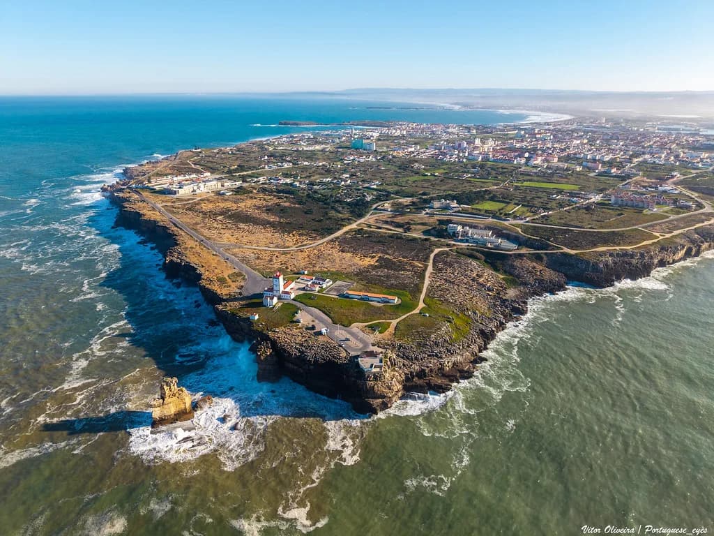
Cabo Carvoeiro: Peniche's Atlantic Cape and the Nau dos Corvos
Cabo Carvoeiro is a limestone cape on the Atlantic coast of the Peniche peninsula, and it rewards a short stop rather than a half-day: expect clifftop paths, the Nau dos Corvos rock offshore and a wide Atlantic horizon. It is the second-most westerly cape in mainland Europe, which is a more modest claim than the westernmost-point billing some visitors arrive expecting. This guide covers what you see, how long to allow and how the cape fits into a Peniche visit.
What Cabo Carvoeiro actually is
The cape is a headland of pale limestone at the western end of the Peniche peninsula, shaped by storms and salt spray rather than by any built attraction. Its pull is geological and scenic: broken rock platforms, fissures and a flat-topped plateau that ends abruptly above the water. Treat it as a landscape visit, not a museum one, and plan your time around the weather rather than around opening hours.
Part of the cape's appeal is that it has no ticket desk, no turnstile and no prescribed route. You walk out, look, and walk back, which makes it a natural add-on to a morning in town rather than a destination in its own right. The wider set of sights around the peninsula is set out in the Peniche Attractions guide if you want to build a fuller day.
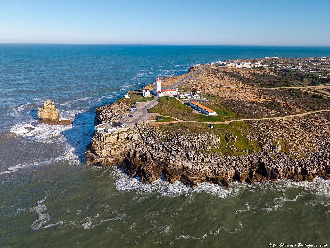

Where the cape sits and how to reach it
Cabo Carvoeiro lies on the Atlantic-facing side of the Peniche peninsula, reached by the road that continues along the coast past the harbour and the fortress. By road it is a straightforward drive or taxi ride from the centre; on foot it is a longer coastal walk that suits anyone with time and decent shoes. Because no source here gives a reliable walking time or bus timetable, check locally on arrival rather than planning around a fixed minute count.
If you are coming from Lisbon, Peniche is the practical base and the cape is the last leg. Bring a windproof layer even in summer, since the headland is exposed on all sides and there is little shelter once you leave the car. Drivers should expect an unlit, open approach road and park considerately at the end rather than blocking the turning area.
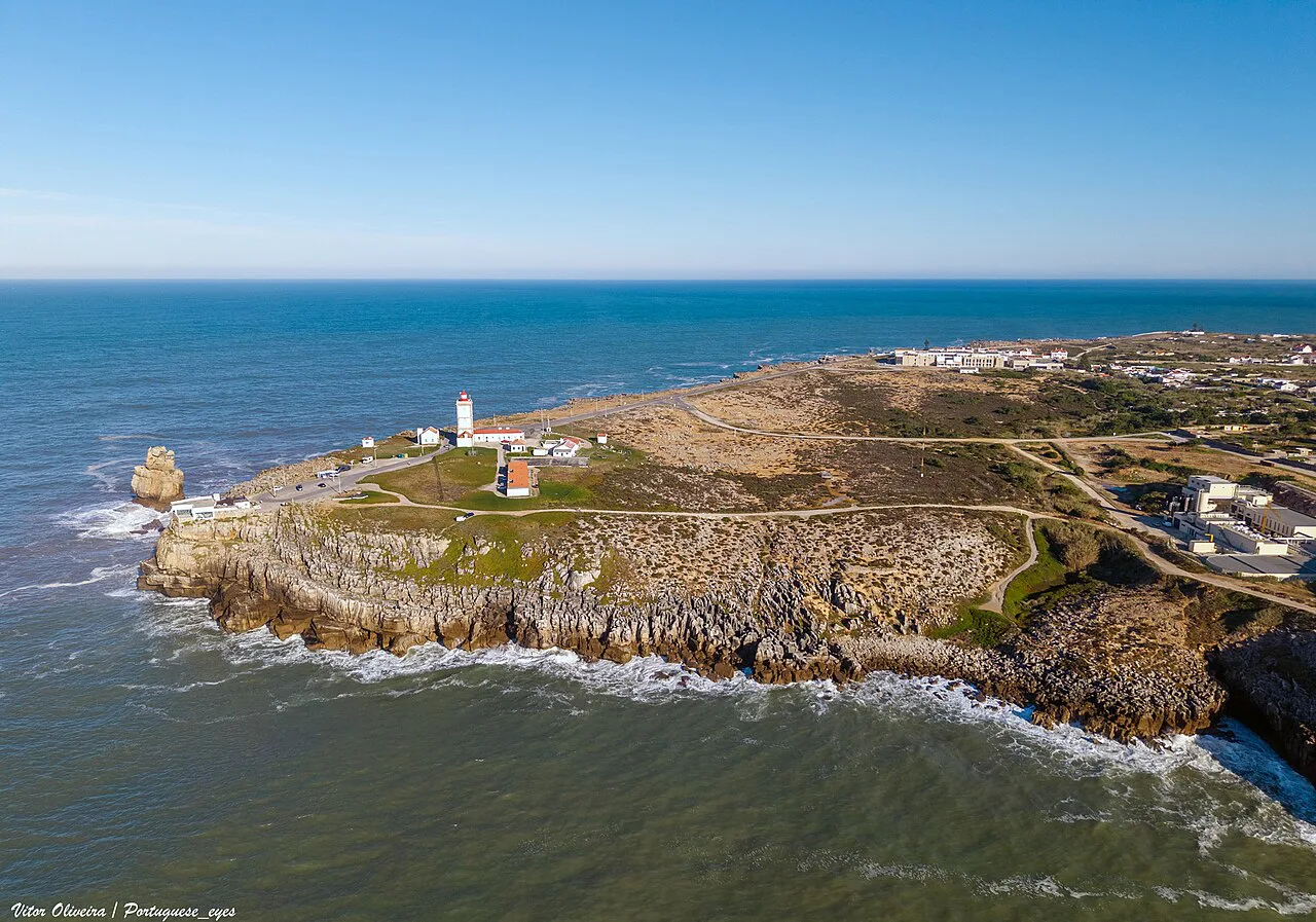

The Nau dos Corvos and the rock beneath your feet
The Nau dos Corvos is the rock formation offshore from the cape, associated with the headland's limestone and storm-shaped geology. It sits in a stretch of coast where limestone layers are exposed, which is why the cape is described in geological terms rather than as a pretty viewpoint alone. Look for the tilted strata and the collapsed hollows where the sea has worked into the rock.
This is also a place where the Atlantic makes itself felt. Winter storms have repeatedly reshaped the cape and left boulders and spray-washed ledges along the lower platforms, so the formations you see are a snapshot rather than a fixed set piece. Stay on the upper paths and resist the urge to scramble down for a closer look at the water.
What you see from the clifftop
From the top of the cape the view runs along the coast and out to sea, and on a clear day it can reach the Berlengas islands offshore. Low vegetation frames the shot, but the main event is the horizon: open water and the sense of standing at the edge of the continent. Bring binoculars if you have them; the islands and passing birds are the details worth looking for.
Photographers do best in low, angled light, when the limestone picks up colour and the sea shows texture instead of glare. Midday tends to flatten the scene and the wind can make a steady handheld shot difficult, so a quick visit works better than a long stakeout. If the cloud is low or the spray is up, accept that the view may close in and come back another day.
How long to allow and how it fits a Peniche day
Budget under an hour at the cape itself: the paths are short, the viewpoints are close together and there is no interior to work through. It works best as an early stop before the town wakes up or a late stop after the fortress, and it combines naturally with the harbour area a short drive back towards the centre. The Peniche port is the obvious next call if you want to stay near the water.
Anyone spending a full day in town can pair the cape with the Peniche fortress, which anchors the peninsula's history and gives the day a built counterweight to all that wind and rock. Build the ordering around opening times rather than distance, and keep the cape flexible so a change in weather does not wreck the plan.
Walking the clifftop safely
The main practical constraint at Cabo Carvoeiro is the combination of wind and exposed edges. Paths can run close to drops, spray can make the rock slick, and gusts arrive without warning on the plateau, so keep children and dogs close and stay back from the lip. Wear shoes with grip rather than smooth soles, and avoid the very edge when the sea is running high.
Treat the cape as a bring-your-own stop: water, a layer and a charged phone. Parking charges, visitor facilities and any staffed information point are not confirmed for the site, so check what is available when you arrive rather than planning around a café or toilet. In poor visibility or strong winds, cut the visit short and save the headland for another day.
Nearby: Peniche town and the Berlengas link
Back in Peniche, the compact centre is walkable and the church of the Igreja de São Pedro, Peniche is a worthwhile pause on the way through the old streets. It sits among the town's everyday fabric rather than on a tourist circuit, which makes it a good counterpoint to the exposed drama of the cape.
Peniche is also the mainland departure point for boats to the Berlengas, and the island group can be visible from the cape on a clear day. Crossings depend on sea conditions and operator schedules, and no source here gives timetables or fares, so book through the operator you choose and confirm the day's running before you commit. If you only have a short break, the cape plus the town is the safer pairing.
For the wider picture of the peninsula, the Peniche Attractions: 4 Visitor Guides collection sets the cape alongside the fortress, the port and the town churches in one place. Use it to decide how much of the day the headland deserves rather than to plan a route between fixed times.
Is Cabo Carvoeiro worth the detour?
Yes, if you are already in Peniche and you accept it as a short, weather-dependent stop rather than a day out. The Nau dos Corvos, the limestone platforms and the open view towards the Berlengas justify the drive, and under an hour is enough to see it properly. Skip it in low cloud or a gale, when the edge is the only thing you will notice.
Build the rest of the day around the fortress and the harbour, keep the cape flexible and carry a windproof layer. That way a change in conditions costs you a stop rather than the whole plan.
Frequently Asked Questions
Is Cabo Carvoeiro the same as Carvoeiro in the Algarve?
No. Cabo Carvoeiro is a limestone cape on the Peniche peninsula, on the Atlantic coast of central Portugal. Carvoeiro is a separate resort village in the Algarve, several hours' drive south, so search results and travel advice for one often do not apply to the other.
Can you drive right up to Cabo Carvoeiro?
A road runs from Peniche towards the cape, so arriving by car or taxi is straightforward. Parking charges, facilities and any access restrictions are not confirmed for the site, so check the signs and conditions when you arrive rather than assuming a car park with services.
Do you need tickets or a booking to visit the cape?
The cape is treated here as an open coastal headland rather than a ticketed monument, and no entry desk or booking is described in the available information. Any organised tour, lighthouse access or visitor centre arrangements should be confirmed locally, as details vary and are worth checking before you set out.