
Boca do Inferno: visiting the Hell's Mouth chasm in Cascais
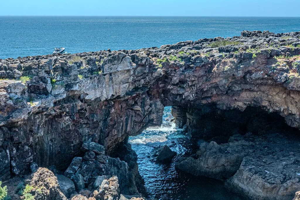
Boca do Inferno, Hell's Mouth, is a collapsed sea cave and natural arch cut into the limestone cliffs of the Costa da Guia about 2km northwest of Cascais, and it costs nothing to see from the viewing platform. Allow around 20 minutes at the chasm, reach it on a flat 20-minute coastal walk from town, and treat it as the reward at the end of that stroll rather than a destination in its own right. This guide covers the walk, the practical return-trip problem, the rock, the timing and the nearby craft stalls and seafood restaurants.
What Boca do Inferno actually is
The feature is a gaping chasm and sea arch carved into the cliffs, not a beach or a cave you can walk into. The Atlantic has exploited a weakness in the rock, and the viewing platform looks down into the opening rather than around it. It sits on the Costa da Guia, the eroded cliff line 2km northwest of the town centre.
Entry to the platform is free, with no charge for looking over the edge. That makes it an easy addition to a coastal walk; it is a short stop, not an attraction with a ticket desk and a queue. If you are weighing up which cliff sights to build a day around, it belongs in Cascais Attractions: 7 Visitor Guides as a natural feature alongside the town's museums and lighthouse.

Why it is called Hell's Mouth
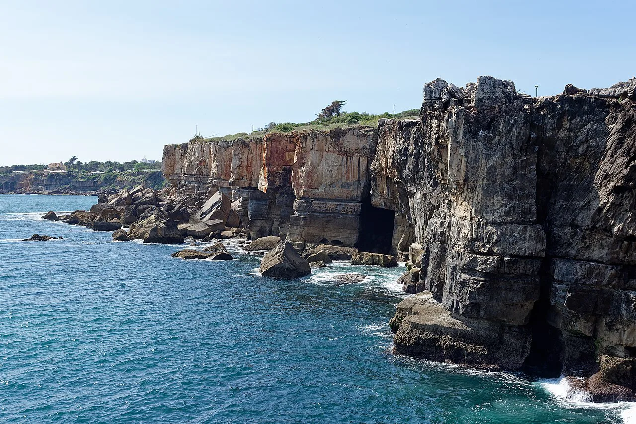
The name comes from the way the sea behaves in rough weather, when Atlantic swell is forced through the arch and surges up inside the chasm. On stormy winter days the water can explode upward like an eruption; on a calm summer day the same place can feel tame by comparison. The drama is seasonal and weather-dependent, so plan for the possibility of a quieter scene rather than a guaranteed spectacle.
How to get there: the coastal walk from Cascais
The best approach is on foot, heading west out of the centre along Avenida Rei Humberto II de Itália, the coastal road also written as Avenue Rei Humberto II de Itália. The route is flat and suitable for all, takes about 20 minutes, and passes the Museu Condes de Castro Guimarães and the Santa Marta Museum on the way. The path is wide enough to double as a cycle path, which continues all the way to Guincho Beach.
Starting from the town end of that avenue, the walk slips past the green edge of the Parque Marechal Carmona, where the shaded paths make a gentle warm-up before the exposed clifftop stretch. The Santa Marta Museum named on the route sits in the coastal fort and lighthouse complex, so a short detour to the Farol de Santa Marta breaks the walk nicely. If you would rather split the day between gardens and coast, pair the chasm with the gardens and the small museums on the same avenue, then walk back into the centre for lunch.
Getting there without walking
A taxi from the Cascais train station to the chasm was quoted at €7 to €9, but the return leg is the catch: finding a taxi at the cliff end can be difficult. Ride-hailing was estimated at €4 to €5 each way and presented as the more reliable option, which matters if you are visiting with older companions or at the end of a long day. Treat those figures as the source's stated range rather than a live quote, and check the app on the day.
What you see from the platform, and how the rock formed
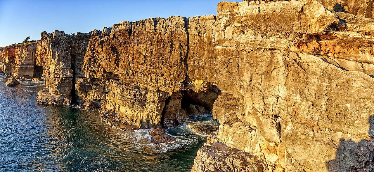
From the platform you look down into the sea arch and along the jagged, dark-grey cliffs of the Costa da Guia. The rock is Cretaceous limestone roughly 90 to 100 million years old, eroded by slightly acidic rainwater dissolving it and by salt crystals expanding in cracks and prising it apart. Algae, cyanobacteria and lichens give the cliffs their dark cast, which is why they do not look the creamy white of textbook limestone.
How long to allow
A typical visit to the viewpoint takes around 20 minutes, which includes watching the water and walking the short stretch of cliff path. If you arrive as part of an organised tour, 10 minutes is enough to see the cliffs and the arch before the group moves on. Add the 20-minute walk each way from the centre, and the outing fills roughly an hour without rushing; extend it if you stop at the stalls or a café.
When to go: storms, calm days and sunset
Stormy winter days give the most theatrical show, when waves crash through the sea arch and spray fills the chasm. Calm summer days are milder and can feel a bit tame, so set your expectations accordingly. Late in the day the platform faces the open Atlantic and is a good spot to watch the sun go down over the water.
Safety on the cliffs
Stay behind the barriers and on the marked path. Locals fish at the very edge of the cliffs, and following their example is dangerous; people have been swept off or slipped down these rocks. In winter or during storms the viewpoint may be closed, so build in a fallback such as the museums along the avenue if the weather turns.
Is it worth the trip?
It is worth it as the end point of the coastal walk from Cascais, not as a reason to travel out from Lisbon on its own. The chasm is an interesting cliff feature, but it does not rival the great sea caves of the Algarve, and the walk is a large part of the pleasure. Pair it with other things to do in Cascais rather than making it the whole outing.
One common mix-up is with Cabo da Roca, the westernmost point of mainland Europe, which lies 13km to the north. Boca do Inferno is not that point, and a visit here does not substitute for the drive north.

Nearby: craft stalls, seafood and the path to Guincho
Right by the chasm, the Mercadinho Boca do Inferno is a row of market stalls selling regional handicrafts and gifts, generally cheaper than the tourist shops in the centre. For a sit-down meal, Mar do Inferno specialises in seafood with a sea view, while the neighbouring Rocha do Inferno café is a less expensive option that has been run by the same family for over 80 years. Neither venue's opening hours are set out here, so check before you build a meal around them.
The clifftop path continues west beyond the chasm towards Guincho Beach, a pleasant cycle route when the wind is not fierce. Strong winds are the trade-off, and they can be surprisingly sharp on this exposed stretch. If you have already seen the lighthouse and the gardens, the Museu do Mar Rei D. Carlos or the Centro cultural de Cascais make sensible extras back in town.
Walk it, or take the ride-hailing app?
Walk from Cascais if the weather is fair and you have an hour to spare, because the flat coastal route past the museums is half the point. If mobility or time makes the walk impractical, book a ride-hailing car and arrange the return before you leave, since taxis at the cliff end are scarce. Either way, check the weather and any closure notices on the day you plan to go.
Explore more Cascais guides
Frequently Asked Questions
Can you swim at Boca do Inferno?
No. The chasm is a viewing feature in dangerous cliffs, not a bathing spot, and the water surges through the arch rather than forming a sheltered bay. The nearest swimming is elsewhere along the coast.
Is Boca do Inferno the same as Cabo da Roca?
No. Boca do Inferno is the collapsed sea cave 2km west of Cascais, while Cabo da Roca is the westernmost point of mainland Europe, 13km to the north. The two are often confused, but they are separate sights with different appeal.